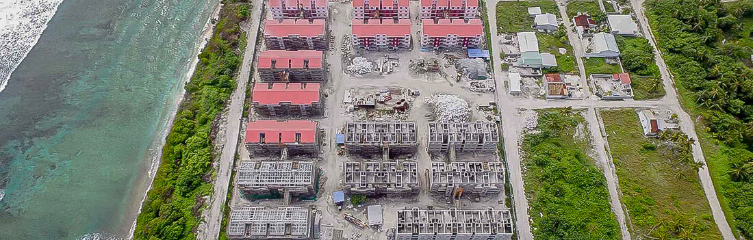
Construction Services
Contour Aerial use UAV’s to collect survey-grade data for the construction industry. This is done quickly, cost-effectively, and safely to ensure that there are limited, if any, disruptions to your job site. Contour Aerial can provide value to your project throughout the pre-construction phase, the build phase, and post construction/documentation phase.
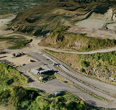 3D Model
We can quickly produce high-resolution 3D models of all or part of your worksite and/or individual pieces of infrastructure post-build, which can easily integrate into your internal software to ensure compliance with your BIM processes.
Alternatively, we can produce a 3D pointcloud file of your site for integration into your survey software. This output can be tailored to your specific needs, including but not limited to: specific file sizes; a specific number of points; and/or using different coordinate reference systems.
2D Georeferenced Orthomosaic Map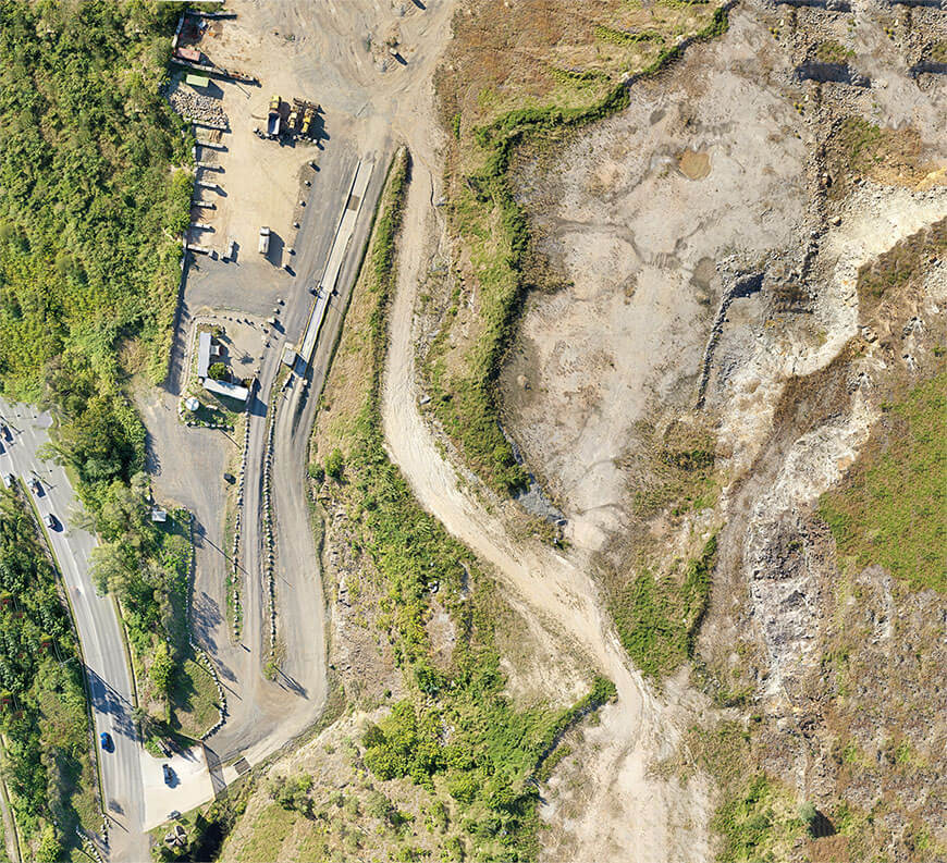
Whether you need a one-off image or multiple images of your job site over a period of time, Contour Aerial can provide you with high resolution (approx. 1.5cm/pixel) 2D georeferenced, orthomosaic maps.
These maps can be for a variety of uses such as progress reporting, marketing, or to provide more information/data for your internal survey teams. Overall, these reporting outputs will assist construction teams to make proactive decisions via actionable data.
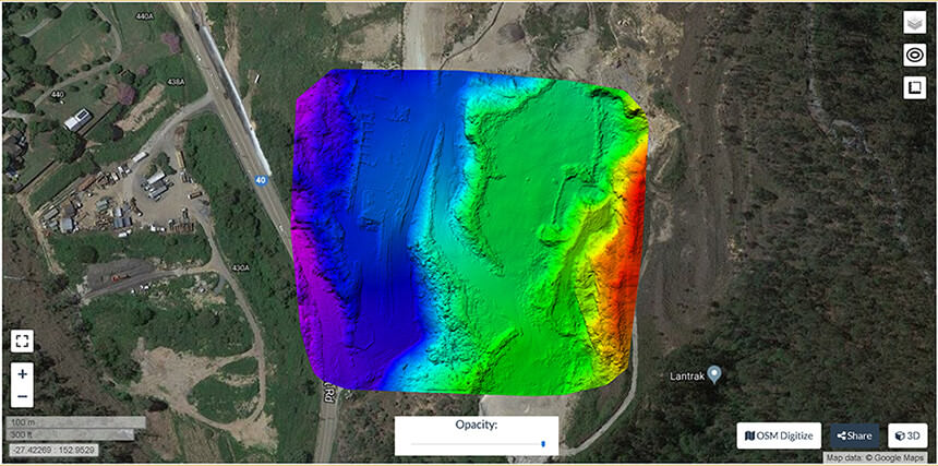
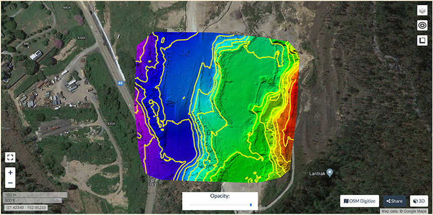 DEM and Contour Map
To assist with the planning of, and reporting on, your construction project, Contour Aerial can produce accurate Digital Elevation Models (DEMs) and/or Contour Maps of your site. DEMs and Contour Maps have a variety of uses, but are commonly used for modelling water flow, creating relief maps, line of sight analysis, and general GIS use.
Contour Aerial's high resolution DEM and Contour Maps can be tailored to suit your specifications, and we will provide you with all raw data along with the final report.
Cut and Fill Volume Calculations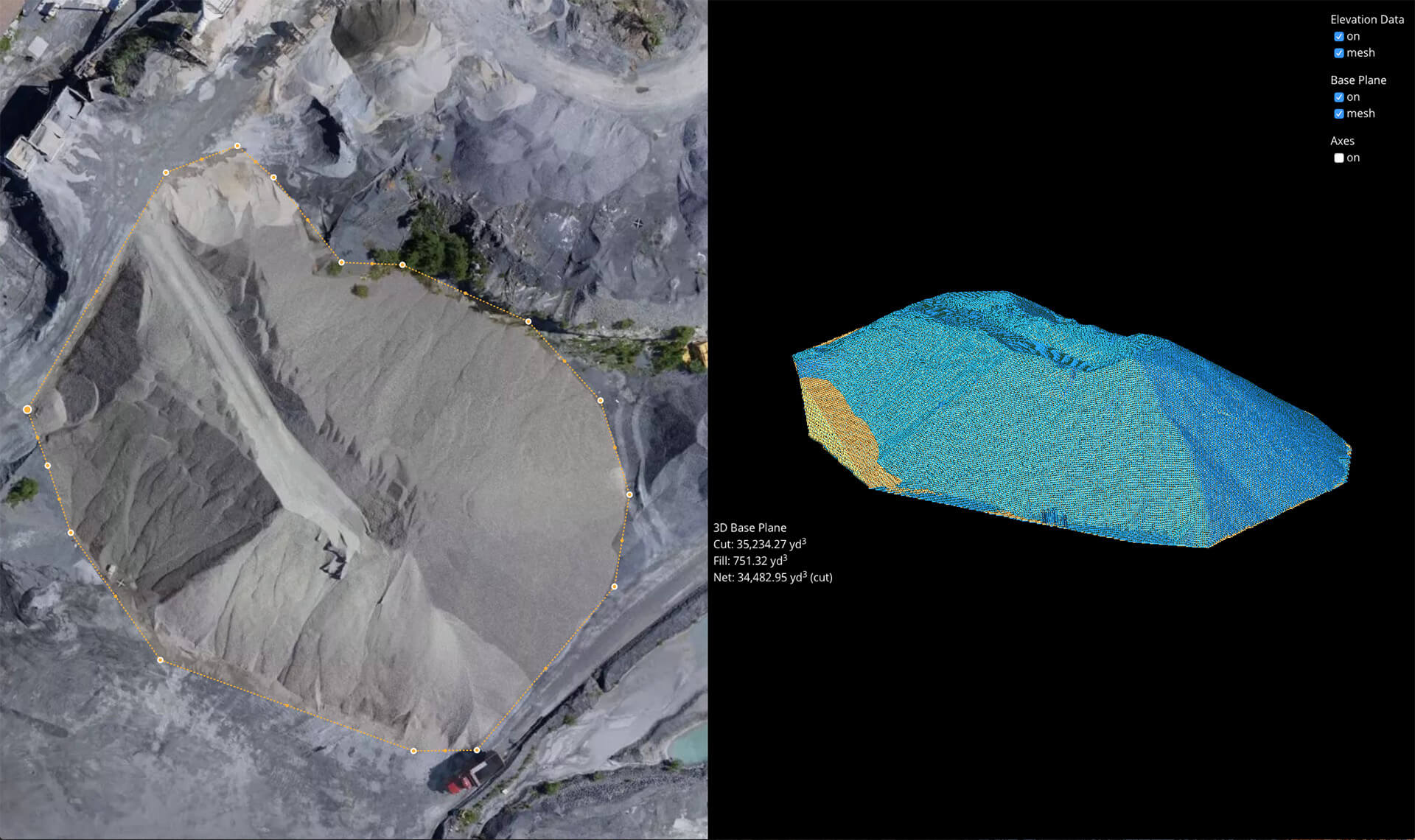
If you are looking to get accurate cut/fill volume calculations without incurring the time and costs associated with a team of traditional surveyors, Contour Aerial can quickly, efficiently, and accurately calculate all your cut/fill volumes, so that you know what your stockpiling, how much you are stockpiling, and the value of your site’s stockpiles.
What Next?
We would love to hear from you, and have an opportunity to demonstrate our capability.
Contact Us for a comprehensive discussion on your project’s needs.